
A common indicator of human activity on the landscape is the disturbance of native vegetation. Native vegetation provides many functions that we depend upon including holding moisture, binding the soil together and stabilizing it, assisting water in infiltrating into the ground, providing habitat and weed control. In this project we are working alongside a producer to improve the management of a stream channel within field that is being used to grow crops. Stream channels in fields where crops are grown often experience erosion due the removal of woody vegetation either by overspray or mechanical removal. Without woody vegetation in their channels and riparian zones, streams are more susceptible to erosion. This erosion creates steeper and more uneven terrain, something that is difficult to farm. Challenges in seeding and harvesting often lead to the establishment of weeds. Treating these weeds often leaves areas with minimal vegetation. And the cycle continues.
Enter the drone. Drone seeding now makes the reseeding of uneven and step surfaces so much easier. We are using the drone to re-establish grasses the will help squeeze out weeds like Canada Thistle and reduce erosion. To help re-establish woody vegetation we are employing livestaking and will talk about this in an upcoming post.
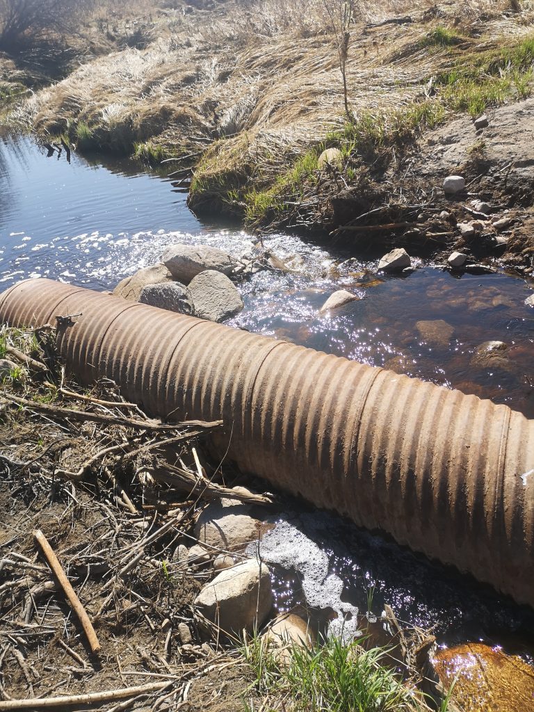
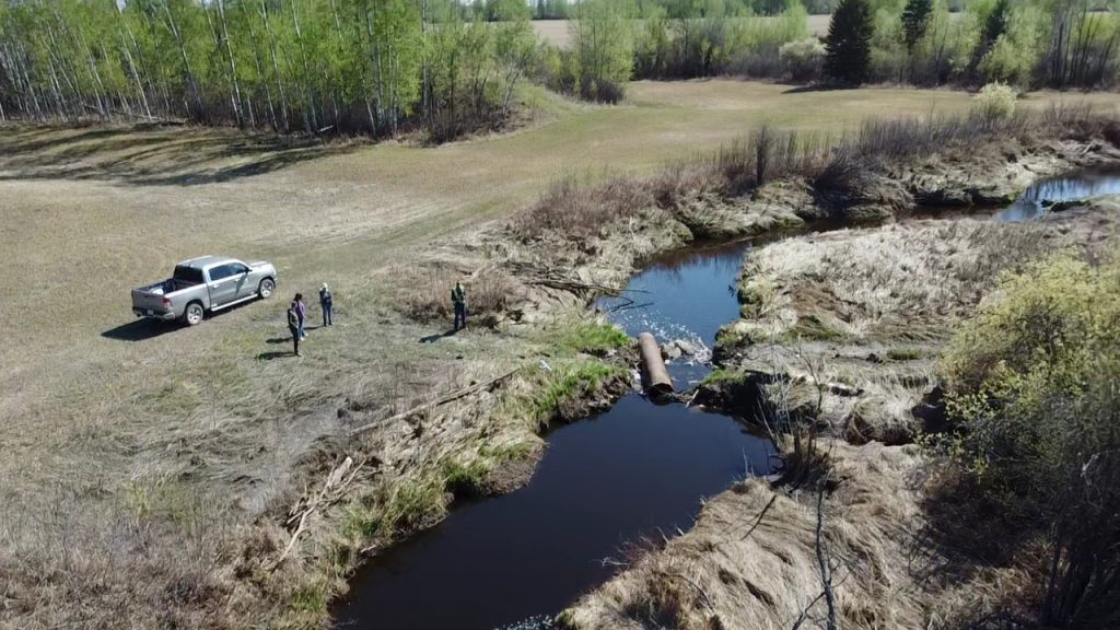
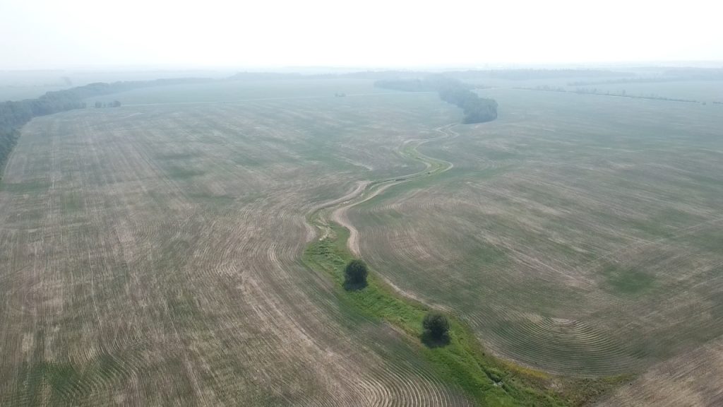
Slower water has less energy to carry sediment resulting in reduced erosion. In the photo below, the areas of white is called a riffle and indicates areas of accelerated water flow. In the aerial photo and close up of the culvert, it obvious that the culvert installation has changed the flow (hydrology) of the creek. .
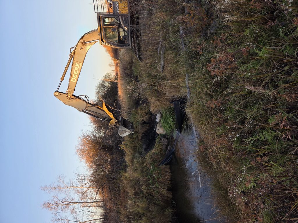
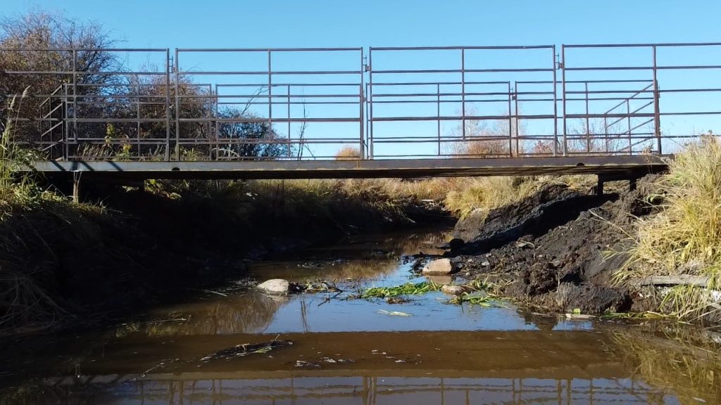
In order to improve stream function, we need to change how humans are doing things on the landscape. Culverts have made roads and infrastructure possible in places where they could not have been before. The downside is that they often restrict stream flow, lead to erosion and can be a fish passage barrier. The solution is to install a better crossing. Bridges are expensive but much better for streams and how they function. Our approach to crossings uses recycled materials and minimizing costs so that it is a more affordable option.
The washed out culvert was removed and the banks were restored to their pre-culvert width.This allows the hydrology (how water flows) of the stream to be free of the constriction created by the culvert. Wider banks spread water out and therefore the same amount of water passes by this spot spread across a wider channel resulting in slower flows and less erosion. Below there is a photo of the completed crossing. The video above follows Snake Creek from below the crossing to above the crossing. On the left hand side of the screen chutes on the crossing can been seen which help guide livestock onto the crossing. The right hand side has a gate which can be closed.
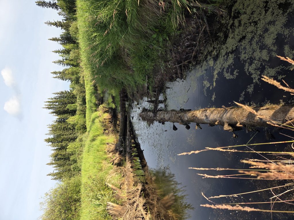
One of the functions of streams or creeks is to move water from where precipitation lands on the earth to lakes, larger rivers or oceans. Another function of the stream system is to disperse energy. It does this by meandering, creating the typical S-shaped curves we see in streams and rivers. Additionally, the vegetation – grasses and trees – as well as the debris – fallen trees and rocks provide resistance to the flowing water dispersing the energy of the moving water. When this happens, some of the water has time sink into the hyporheic zone, which is the area underneath the bank that is saturated with water. This process is a bit like filling a sponge with water and once water is stored here it can also be released back to the stream when there is not as much water flowing through it.
What we want to see these streams in fields doing is storing away water in the soil during spring runoff and rain events. Afterwards, when it is drier these stores of water can slowly be released. This helps keep the stream flowing longer and reduces the water stress on the crops growing there.
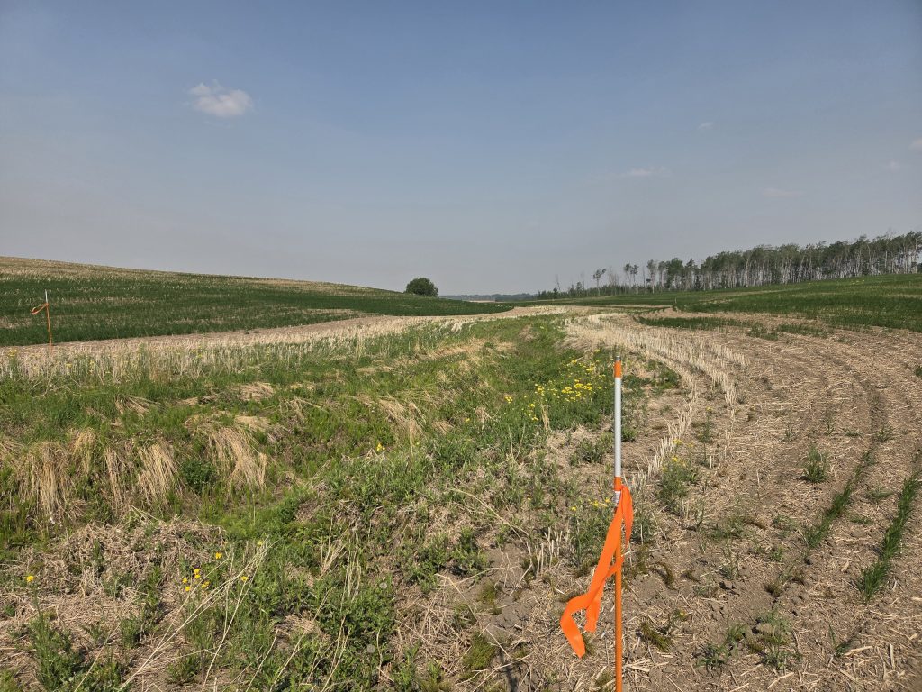
This project is working with farmers to improve ag practices. One of the real tricky pieces are draws, ephemeral creeks, gullies, ditches or one of the thousand other names that they are known by. They are wet sometimes but not all of the time, so often they are seeded when it is dry. When they end up without the appropriate vegetation or ruts they can start to erode and carry off precious soil. So we are working with a farmer to see if there is a better to farm land that has these ephemeral creeks (only flow irregularly). To start off we are using marked buffer zones to prevent overspray, unnecessary seeding, rutting and to maintain vegetation in the ephemeral creek.
Flood and Drought Resiliency, as well as water quality, are dependent on functioning stream channels with connectivity to the hyporheic zone, floodplain and longitidunal connectivity of the stream. This project will improve the function of small tributaries in the Peace Watershed through a variety of approaches. Crossing structures, adjusted agricultural practices and bioengineering will be employed to minimize and restore the impact of human activity on selected small tributaries. We are engaging with municipal partners and landowners/producers to improve management practices and also to undertake restorative and enhancing work on their properties. Although there is some direct outreach planned, the hope is for successful improved management practices to be shared by word of mouth from neighbour to neighbour. This project will provide in-community demonstration of practices something that is a powerful tool for supporting adoption of Beneficial Management Practices.
It is great to be working on this project with our partners Mackenzie County and Northern Sunrise County. We would like to thank Alberta Environment and Protected Areas for provide funding towards this project through the Watershed Resiliency and Restoration Program.